Over 50 years ago, the idea for a destination trail that connects Berks County to Philadelphia was born and took root with the formation of Schuylkill River Greenways. What we not know as the Schuylkill River Trail existed in unconnected sections known by the names given to them locally. Thanks to the consistent efforts of partners throughout the watershed, the SRT now stretches from Schuylkill County to Philadelphia as a unified trail. Partners are working to close gaps, connect to other trails, and improve the quality of life for residents of the Schuylkill River watershed.
The trail partners listed below work together to build, improve, and maintain the Schuylkill River Trail from Philadelphia to its eventual terminus in Frackville. If you are looking for area specific information for teh SRT, check out our partner pages below. You can always contact Schuylkill River Greenways at info@schuylkillriver.org or 484-945-0200 for general trail information.
Philadelphia, South of the Art Museum
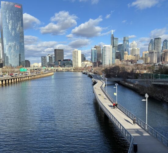
The Schuylkill River Development Corporation (Schuylkill Banks) manages the trail from the Fairmount WaterWorks to South Street, a section known as Schuylkill Banks. The Schuylkill Banks vision calls for trails running along both banks of the Schuylkill River wherever possible between the Fairmount Dam and the Delaware River. SRDC is currently working with public and private partners to plan, design and build additional trail segments and improve neighborhood connections to the trail.
Philadelphia, North of Art Museum
The Philadelphia Parks & Recreation protects over 10,200 acres of public land and waterways, and manages hundreds of recreation, environmental, and cultural centers. The department manage historically significant Philadelphia events and special venues, and works with communities and organizations, leading capital projects and introducing creative programming.
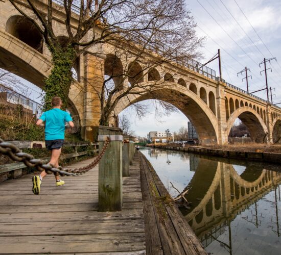
East Falls is a neighborhood along the banks of the Schuylkill River and over the Falls Bridge. About 11, 000 Philadelphians live in the area. The East Falls Development Corporation is dedicated to community based economic development. They further their mission through small business technical assistance, neighborhood planning, capital improvements, and events.
Manayunk Development Corp
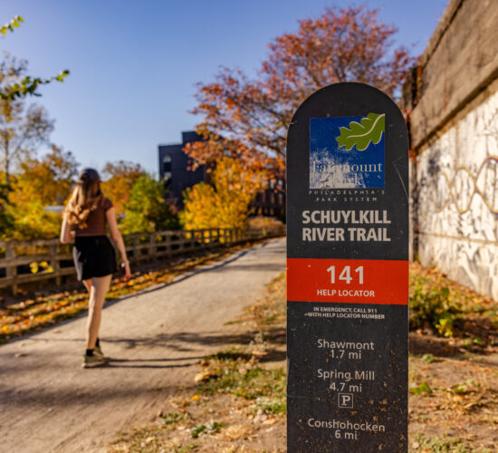
Manayunk is centrally located just 15 minutes from Center City Philadelphia, King of Prussia, Chestnut Hill, and The Main Line. The commercial district is nestled along the banks of the Schuylkill River and the Manayunk Canal and Tow Path. The Manayunk Canal Towpath is the Manayunk section of the larger Schuylkill River Trail and begins at Lock Street in Manayunk and runs just behind Main Street through Manayunk and ending in the Shawmont neighborhood. It’s approximately 2 miles of of a mixed trail of boardwalk and compacted gravel that is best suited for walking, jogging, off-road biking and nature exploration.
The Manayunk Development Corporation and the Manayunk Special Services District are non-profit organization operating under the same umbrella, which are marketed through Manayunk.com.

Montgomery County
The county built, owns and maintains 18 miles of the Schuylkill River Trail that runs from the county line in Philadelphia to Mont Clare, passing through Valley Forge National Historical Park. It was built on the Pennsylvania Railroad right of way and parallels the scenic Schuylkill River as it winds through various townships and boroughs. This section of the trail is paved, making it a popular destination for biking, rollerblading, jogging, and walking. It is recognized as a National Recreation Trail by the U.S. Department of Interior’s National Trails System.
Montgomery County has also completed a section of trail from Pottstown to the Berks County line and is working to extend the Pottstown piece eastward to connect with the trail in Chester County. More information about this trail section can be found on Montgomery County’s website.
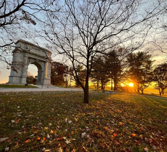
Valley Forge National Historical Park
Valley Forge was the site of the 1777-78 winter encampment of the Continental Army. The 3,500-acres of monuments, meadows, and woodlands commemorate the sacrifices and perseverance of the Revolutionary War generation. There are 21 miles of authorized biking trails in the park including the Schuylkill River Trail. On the park’s north side, two miles of the SRT run through the park, with connections to sites in Montgomery County and Philadelphia.

Chester County and Phoenixville
The Schuylkill River Trail in Chester County runs from Phoenixville to Parker Ford. The Borough of Phoenixville manages the trail within the borough while Chester County manages the other trail sections in the county. The trail is completed through Chester County from the Mont Clare Bridge at Phoenixville north to the Rt. 422 Bridge over the Schuylkill River. Details can be found on Chester County’s website
Additional information can be found for trail miles in Phoenixville at the Borough of Phoenixville website

Berks and Schuylkill Counties
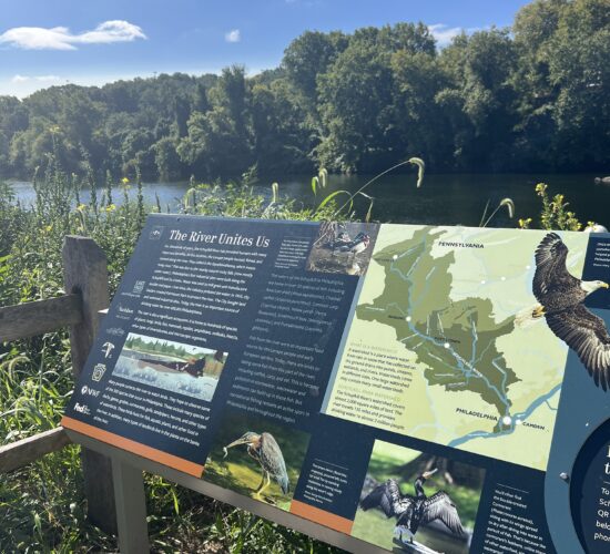
In Berks and Schuylkill Counties, the trail is constructed and managed by the Schuylkill River Greenways National Heritage Area. There are currently over 30 miles of completed trail in this section, including a nearly 20-mile stretch from the Pottstown line to Reading. This section is locally known as the Thun Trail and is maintained by volunteers.
In Upper Berks and Schuylkill Counties, there is a 7-mile length of trail from Hamburg to Auburn, known as the John B. Bartram section, and another 1.5-mile piece in Landingville, and a 1.4-mile segment in Schuylkill Haven. From Reading and Hamburg, cyclists can follow a signed on-road route, with a short off-road piece in Leesport.
The Schuylkill River Greenways NHA is always working to maintain, improve and expand this section of trail, while also working in partnership with others to promote the entire trail.