Geocaching
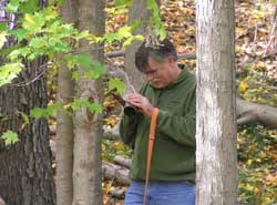
Geocaching is a high-tech treasure hunting game that involves searching for hidden geocaches, which are often old ammo boxes, waterproof plastic containers, or small camouflaged containers. There are hundreds of geocaches along and near the Schuylkill River Trail and in interesting locations throughout the Schuylkill River Heritage Area.
In this section, you’ll find information on geocaches that have been placed along the trail and river, how to get started geocaching, and links to “bookmarked” lists of geocaches. So, spend a day of walking, biking, or paddling to find geocaches, see some beautiful sites, enjoy a picnic lunch or stop into one of the restaurants located near the trail or river.
WHERE TO GEOCACHE ALONG THE SCHUYLKILL RIVER TRAIL
There are over 75 geocaches along the Schuylkill River Trail between Fairmount Park and Conshohocken and another 50 or so between Conshohocken and Valley Forge National Historic Park (VFNHP). Over 85 of these were placed by a group of geocachers calling themselves the “Schuylkill River Trail Association” although they have no formal affiliation with the Trail or the Schuylkill River Heritage Area. There are geocaches throughout the entire length of the trail, but this series provides the most geocaches in a short distance.
Geocachers sometimes create “bookmark” lists on the geocaching website, in order to group caches by a specific location or with a common theme. A bookmark list of caches from Fairmount Park to Valley Forge National Historic Park can be found at
http://www.geocaching.com/bookmarks/view.aspx?guid=ad10e8b9-81c0-4c9f-a3f8-5d6330584da2. An even a longer list of caches along this part of the trail can be found at
http://www.geocaching.com/bookmarks/view.aspx?guid=1c2d3767-38c6-49f5-8f14-d7fe4567300a.
Physical geocaches are not permitted in any national park, therefore you won’t find any in VFNHP, but a few geocachers have placed geocaches just outside the boundaries of the park or created “virtual caches.”
There are a few caches along the trail between Pottstown and Reading, which you can find by searching the geocaching website. The trail continues north along the river from Pottstown to Reading, and there is also a 6.5 mile piece of trail, known as the Bartram Section, from Hamburg to Auburn. Since, the caches in these areas have not yet been organized into bookmarks, you can find them by searching the geocaching website using nearby street addresses or zip codes.
GEOCACHING ON THE RIVER
Over 20 caches have been placed on islands and along with shoreline of the Schuylkill River between the Douglassville Bridge in Douglass Township (Berks County, North of Pottstown) and Tow Path Park in East Coventry (Chester County, South of Pottstown). These caches are organized into a bookmark called Kayak/Water caches. The bookmark is available at:
http://www.geocaching.com/bookmarks/view.aspx?guid=c5c87f89-8cd9-40a4-9224-89dc52113885
GEOCACHING AT HISTORIC SITES
There are many caches located near the Schuylkill River Trail at noteworthy historic sites. For example, Historic Morlatton Village, in Douglassville, is situated along the Trail in Berks County, with a short access trail into the Village. Two caches are located within the Village, and two others are hidden nearby. These four geocaches are bookmarked at http://www.geocaching.com/bookmarks/view.aspx?guid=c585ee64-cbda-404c-b1f2-1cbb54d3aaef
WHAT YOU SHOULD KNOW BEFORE YOU START GEOCACHING
Geocaching has been organized and is managed by Groundspeak. To view geocache locations and details, you must first sign up for a free membership at www.geocaching.com. The Getting Started section of that website will introduce you some basic information about geocaching. You’ll also need a GPS unit or APP on your phone.
Once you’re signed on at www.geocaching.com, check out the “Getting Started” section for a basic introduction. You can search for geocaches in a specific location by clicking on the “Hide and Seek a Cache” link and then entering an address, zip code, or other information. The website will provide you with GPS coordinates (latitude and longitude) which you can enter into your GPS or upload using a USB cable. Geocaches are often located near one another, so you can load a group of geocaches into your GPS. After finding a geocache, sign the “log” kept in each cache and then log your find on the geocaching website.
SAFETY TIPS
- Common sense dictates that geocachers wear appropriate clothing, especially good shoes when geocaching.
- Be careful of ticks, poison ivy, and other outdoor “hazards.”/li>
- During hunting season, wear blaze orange in areas where hunting is permitted.
- When geocaching on the river, wear approved personal floatation devices and follow all paddle safety guidelines.
- Always be respectful of private property and environmentally sensitive areas.
- It is not necessary for geocachers to seek permission in order to hunt for caches. However, if you wish to place a cache on private property, you will need permission from the landowner. All PA state parks and some other publicly owned land require geocachers to obtain permits or permission in order to hide a cache.
Geocaching Sites on the Trail
Fort Washington State Park
Rich in modern recreational facilities and historical significance, Fort Washington blossoms with flowering dogwood in the spring. Birders enjoy the seasonal migration of raptors along Militia Hill from the...
Learn MoreEvansburg State Park
Evansburg State Park is in southcentral Montgomery County between Norristown and Collegeville. Evansburg offers a significant area of green space and relative solitude in an urbanized area. Its main...
Learn MoreGreen Lane Park
Green Lane Park offers fishing, boating, picnicking, horseback riding trails, hiking trails, mountain biking trails, family/organized group camping, equestrian camping, tennis, playgrounds, cross-country skiing, ice skating, and ice fishing....
Learn MoreFrench Creek State Park
French Creek State Park is one of 6 State Parks in the Schuylkill River Heritage Area, and one of the best places for outdoor recreation, rest, and relaxation in...
Learn MoreTuscarora State Park
When viewed from the lake or the day use area, Locust Mountain seems to drop right into the southern side of Tuscarora Lake. The scenic picnic area plays host...
Learn MoreLocust Lake State Park
Known for its popular camping area, Locust Lake State Park nestles on the side of Locust Mountain. The 52-acre Locust Lake is located between two campgrounds and is surrounded...
Learn MoreFairmount Park
Fairmount Park was officially founded in 1855 when the Lemon Hill estate was dedicated as a public park and renamed Fairmount Park. Support came from 2,400 citizens who signed...
Learn MoreNorristown Farm Park
The Norristown Farm Park is a 690 acre Park owned by the Commonwealth of Pennsylvania and is operated and maintained by Montgomery County. The area that encompasses Norristown Farm...
Learn MoreBerks Nature
Berks Nature has been serving the Berks County community since 1974. The Conservancy works with landowners to permanently protect land from development, townships and boroughs on zoning issues, developers...
Learn MoreMorlatton Village
Morlatton Village is Berks County’s first settlement site along the Schuylkill River at Douglassville. The site includes the Mouns Jones House, built by Swedish settlers in 1716, is the...
Learn More