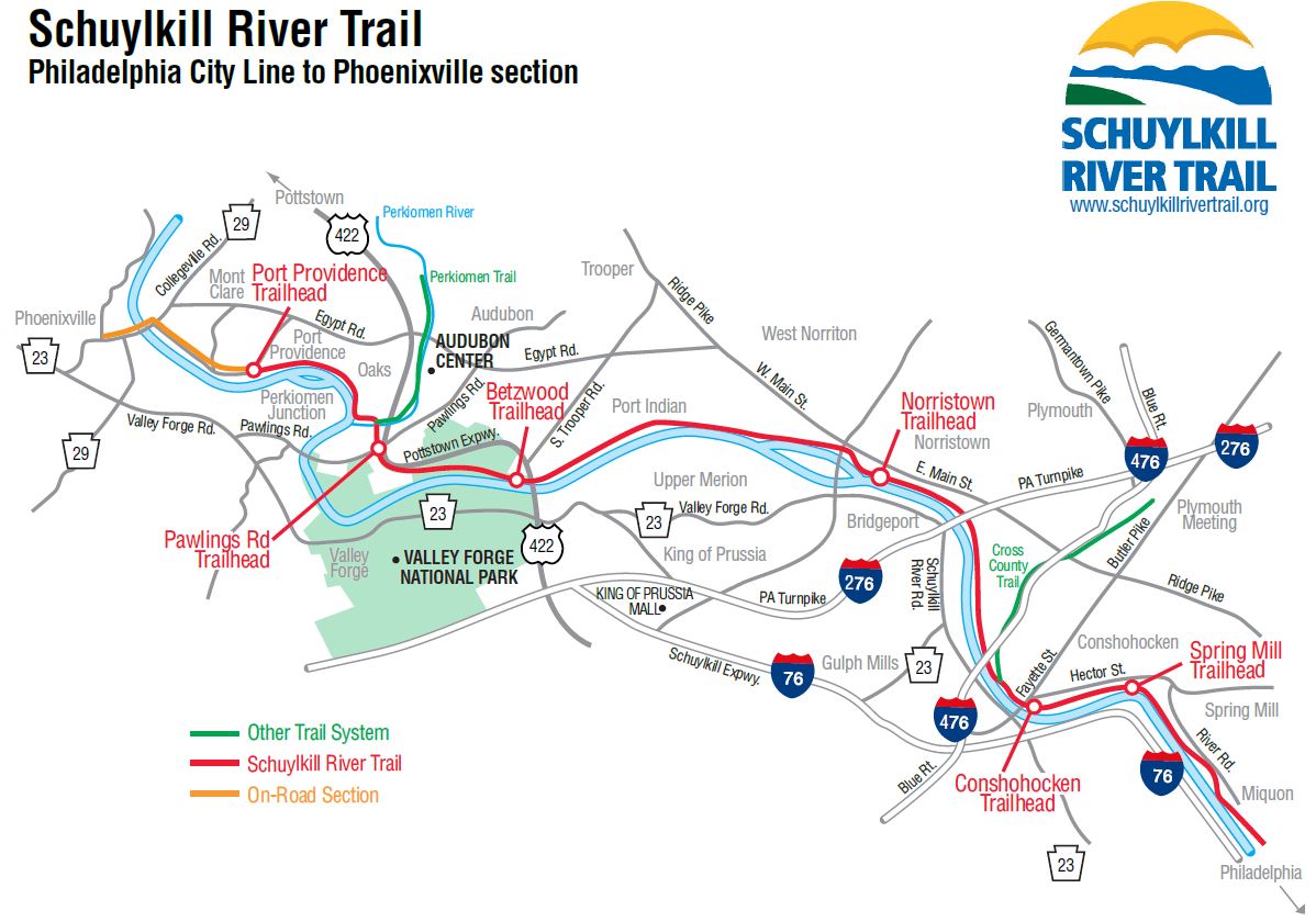
The Expanding SRT
There are currently about 75 completed miles of the Schuylkill River Trail in sections, including 30-plus miles between Philadelphia and Parker Ford. The trail breaks off in Parker Ford and picks up again in Pottstown where it continues for about 20 miles to Reading. From there, cyclists can follow a 20-mile signed on-road route just shy of Hamburg. In Hamburg, trail users can access a scenic seven-mile stretch to Auburn in Schuylkill County. The trail is a great way to enjoy the outdoors, exercise or commute.
Schuylkill River Trail Sections
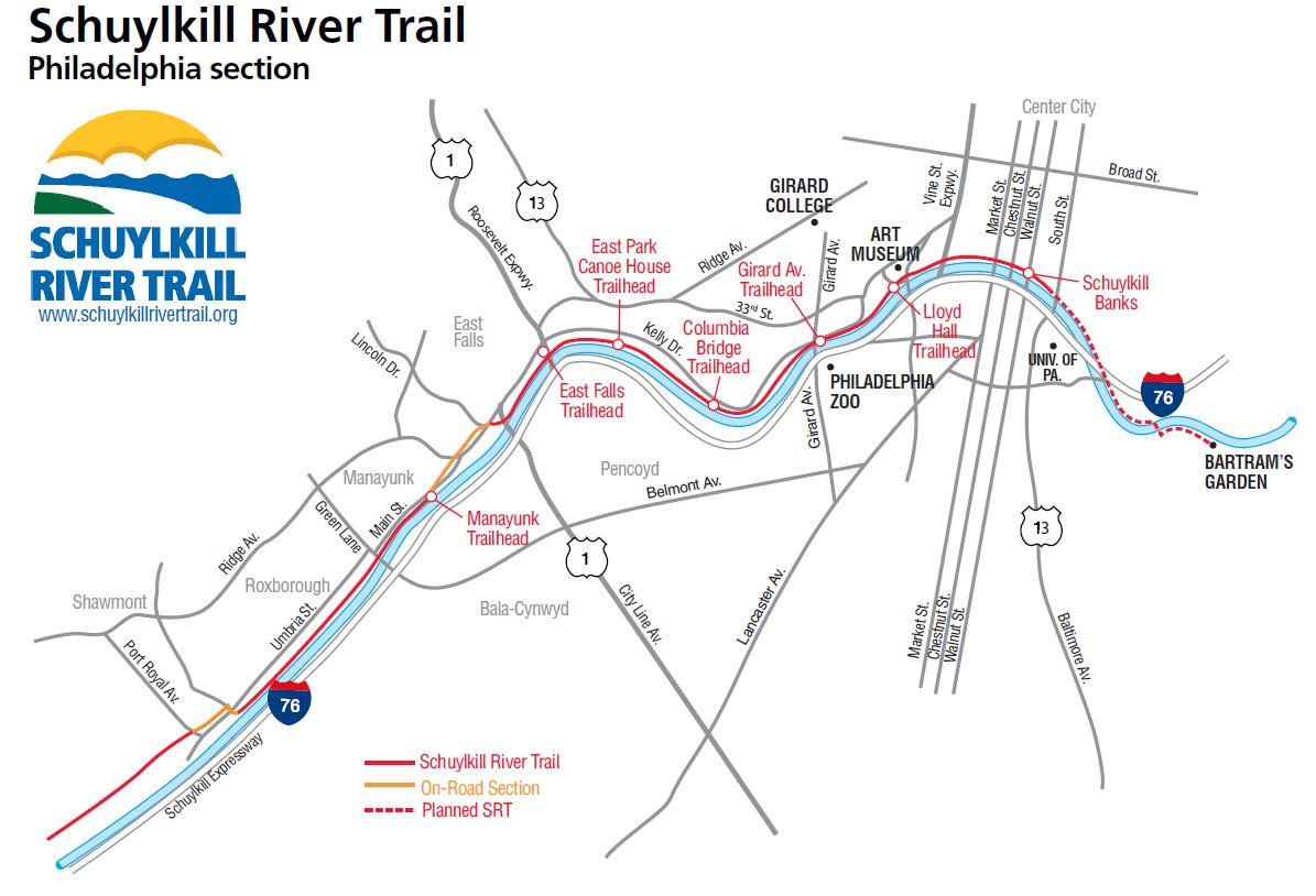
(Click here for a larger view of the map)
There are more than 30 miles of the Schuylkill River Trail in Philadelphia including a section which provides recreational space in the center of the beautiful and historic city. Schuylkill Banks, located between the Fairmount Water Works and Locust Street, is a linear park that hosts a variety of entertainment and recreational events throughout the year. CLICK HERE to learn about the boardwalk that extends the trail past Locust Street.
There is an uninterrupted 37-mile trail stretch between the Schuylkill Banks Trailhead and the Parker Ford Access Trailhead, where there is a gap until it picks back up again in Pottstown.
Trail Segments & Surfaces
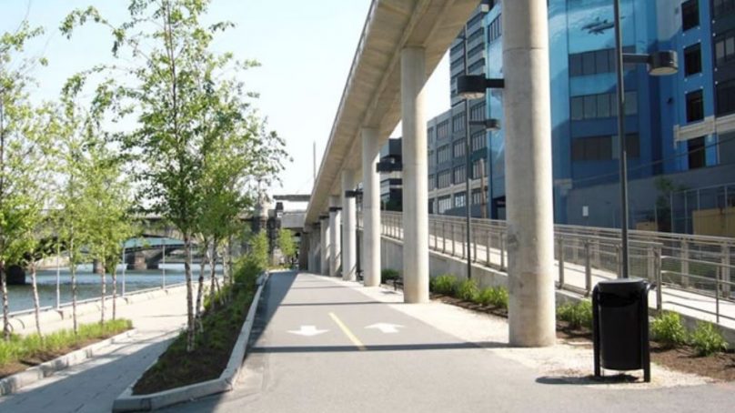
- Bartram's Mile: Bartram's Mile, a 1.1-mile stretch of trail on the west side of the river, will eventually connect to the Schuylkill Banks section of the Schuylkill River Trail in Philadelphia. The 15-foot-wide multi-use path extends along the western bank of the Schuylkill River through the grounds of historic Bartram’s Garden, which was frequented by George Washington, Thomas Jefferson and other boldface names from history. The new trail starts at the 56th Street Plaza and continues for 1.1 miles to the Grays Ferry Swing Bridge.
- Access: The easiest way to enter this new path is at 56th Street and Lindbergh Boulevard, which will bring trail guests right to the 56th Street Plaza, an area that offers prime skyline views. There’s plenty of parking available at this access point.
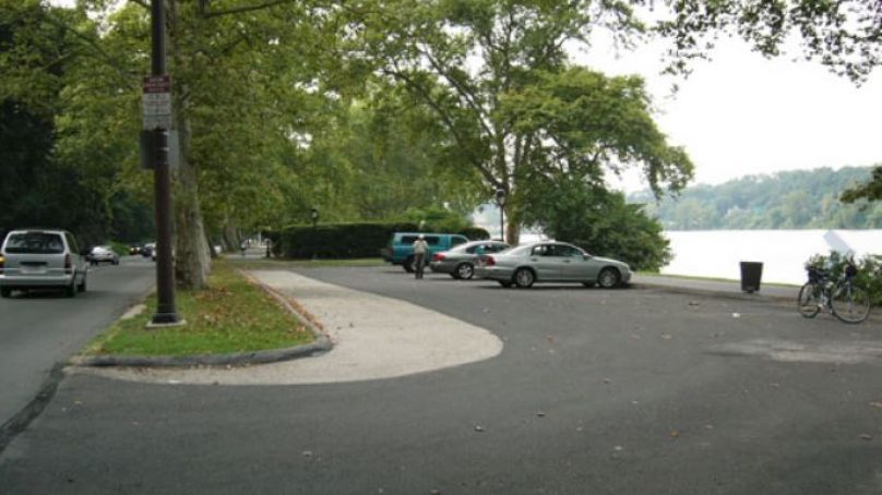
- Schuylkill Banks to East Falls: The trail is a wide paved surface suitable for rollerblading, walking, running and cycling. This section runs next to Kelly Drive and takes users past Boathouse Row.
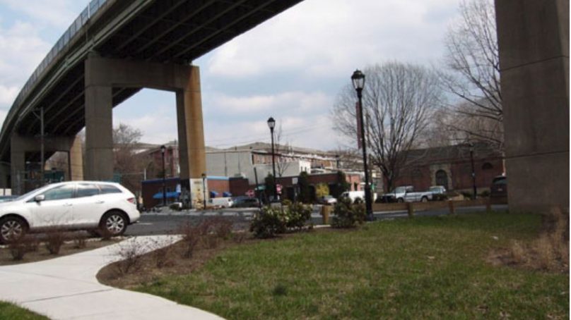
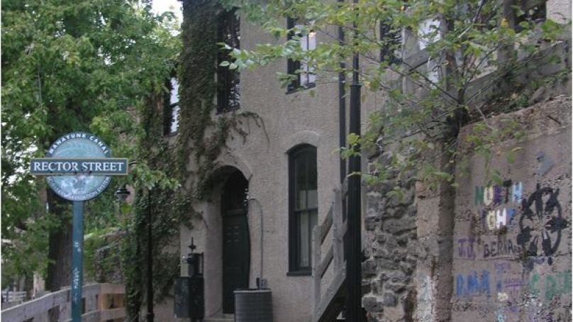
- East Falls to Manayunk Canal Towpath: From East Falls to Ridge Avenue the trail is on sidewalk, Ridge Avenue to Manayunk’s Lock Street uses Main Street, then the trail goes behind Main Street and uses the Manayunk Canal towpath, a section of the Schuylkill Navigation System. The Manayunk Canal towpath varies between crushed stone and wooden boardwalk.
- Shawmont Valley to Parker Ford: After the towpath, the trail continues to Parker Ford where the trail is either a gravel or paved surface.
Trailheads
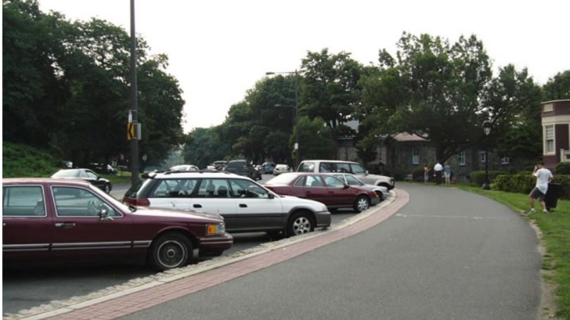
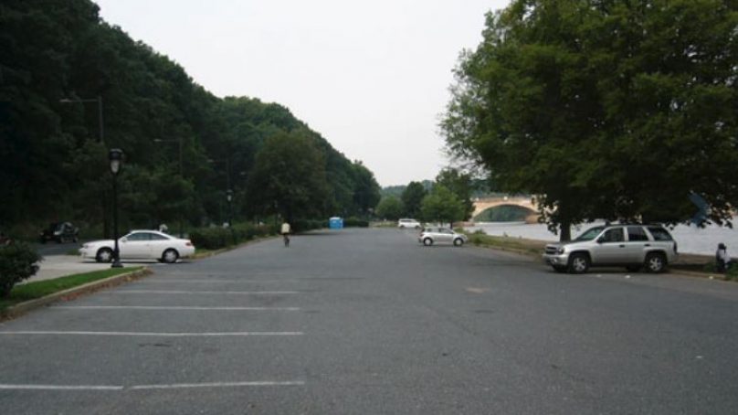
- Girard Ave. Bridge
- East Falls
- Columbia Bridge
- Manayunk
- Schuylkill Banks
- Lloyd Hall/Art Museum
- East Park Canoe House
Sites Along the Trail
Photo Gallery

Boardwalk
Boat House Row
Columbia Bridge
East Falls Kelly Drive
East Park Canoe House
Girald Ave. Bridge
Manayunk Trail

Market Street

Schuylkill Banks Boardwalk
Schuylkill Banks_Market St.
Tow Path in Manayunk
(Click here for a larger view of the map)
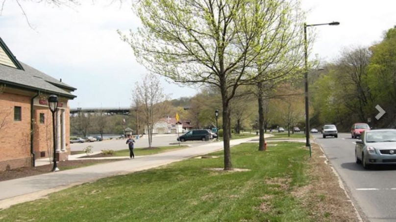
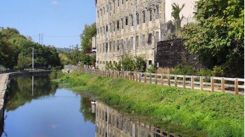
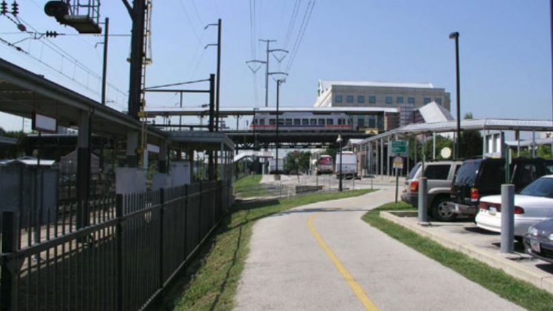
The Schuylkill River Trail between Philadelphia City Line and Phoenixville/Mont Clare is currently about 26 miles in length. This section is owned and managed by Montgomery County who, apart from a short on-road section between Port Providence and Mont Clare, has provided users with an off-road trail with a wide, paved surface. Manayunk’s trendy restaurant scene make it a popular destination for cyclists. This section of trail can be used to access other county trails such as the Perkiomen Trail, Audubon Loop at Oaks and the Cross County Trail at Conshohocken.
The trail runs beside the SEPTA stations at Spring Mill, Norristown and Conshohocken; and provides access to the west side of Valley Forge National Historic Park at Betzwood. In Valley Forge, trail users cross the Schuylkill River via the new Sullivan’s Bridge–a 14-foot wide, 602-foot long bike/pedestrian bridge–to access the main park with its extensive trail system and historic sites. From Port Providence to Mont Clare there is one of the last watered sections of the Schuylkill Canal, and a restored lock tender’s house and lock.
Trailheads
- Conshohocken
- Norristown
- Port Providence
- Spring Mill
- Pawlings Road
- Betzwood
- Port Indian Access
- Pawlings Road
- Port Providence
Sites Along the Trail
Photo Gallery
Norristown trail section
Oaks section
Pawlings Road
Port Providence
(Click here for a larger view of the map)
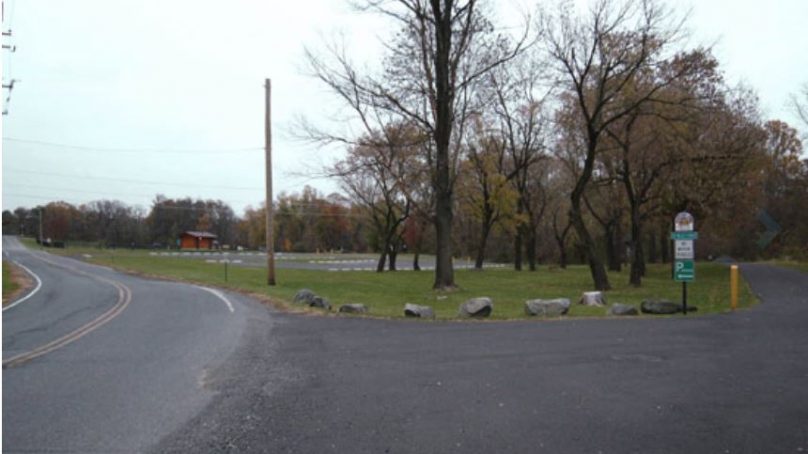
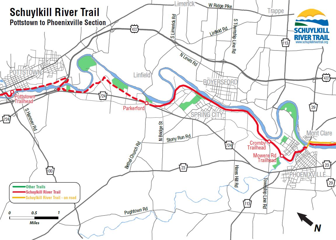
The Schuylkill River Trail between Phoenixville/Mont Clare and Pottstown is the responsibility of the Borough of Phoenixville and Chester and Montgomery Counties. The section from Cromby to Parker Ford (about 100′ south of Linfield Road) is now complete and open to trail users. The surface is mostly crushed stone, although selected areas have been paved, including the Cromby trailhead, Spring City at Bridge Street, and the iron bridge near the Bard complex.
Heading east, a new section of trail opened in April 2015 from Cromby through Phoenixville, connecting with the trail in Mont Clare. Heading west, the final segment (Parkerford to Route 422 bridge, into Pottstown) has not yet been constructed. For current information about the trail’s status visit Chester County’s trail website – Chester County Schuylkill River Trail.
Trail Project Status
Attendees of a public meeting held on Oct. 17, 2018 learned that an integral section of the Schuylkill River Trail is expected to be completed in the next few years. The project is the construction of a shared-use trail between Linfield Road in Parker Ford and the US 422 bridge over the Schuylkill River in Pottstown. To learn more, CLICK HERE.
Completed Section
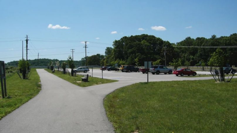
- Cromby to Parker Ford: This is the newest section of trail, opened in December 2011. It measures 5.6 miles, beginning in Cromby, just west of Phoenixville, and ending in Parker Ford. Plans call for extending that piece of the trail several more miles to connect with the Pottstown section. Today, it is a popular segment, mostly crushed stone, but paved in some spots.
Trailheads
Sites Along the Trail

(Click here for a larger view of the map)
From Pottstown to the Berks County line the trail is maintained by Montgomery County, and that section is paved. After crossing into Berks County, the Schuylkill River Heritage Area owns and maintains the trail and the surface is crushed stone. A four-mile section between Birdsboro and Gibraltar is on-road, using Schuylkill Road north from Birdsboro to Robeson Crossing, the trail crosses Rt. 724 and uses Old River Road from Robeson Crossing to Gibraltar.
The Pottstown to Reading section of the trail is a 19-mile piece which begins at Pottstown's Riverfront Park, where it is paved. After the Pottstown piece, the trail follows a tree-canopied path through Berks County. The crushed stone section is known as the Thun Trail. A scenic 4.5-mile on-road section in Birdsboro includes old railroads which offer beautiful views of the heritage area.
Borrow a Bike
Bike Pottstown/Bike Schuylkill is a community bike share program that is managed by the Schuylkill River Greenways NHA. The bikes are free and can be used by anyone ages 16 and up.
Trailheads
- Union Meadows West
- Reading Riverfront
- Keystone Boulevard
- Pottstown Riverfront
- Grosstown Road
- Morlatton Village
- Brentwood
- Birdsboro
- Gibraltar Access
- Angstadt Lane
Sites Along the Trail
Photo Gallery
Angstadt Lane Trailhead
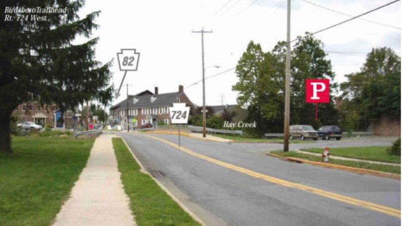
Birdsboro Trailhead
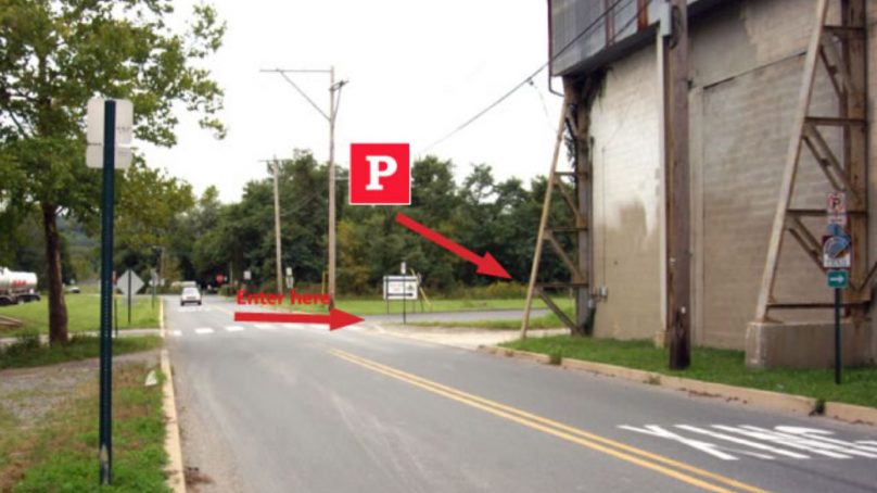
Grosstown Road Trailhead
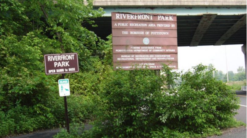
Riverfront Park Trailhead in Pottstown
(Click here for a larger view of the map)
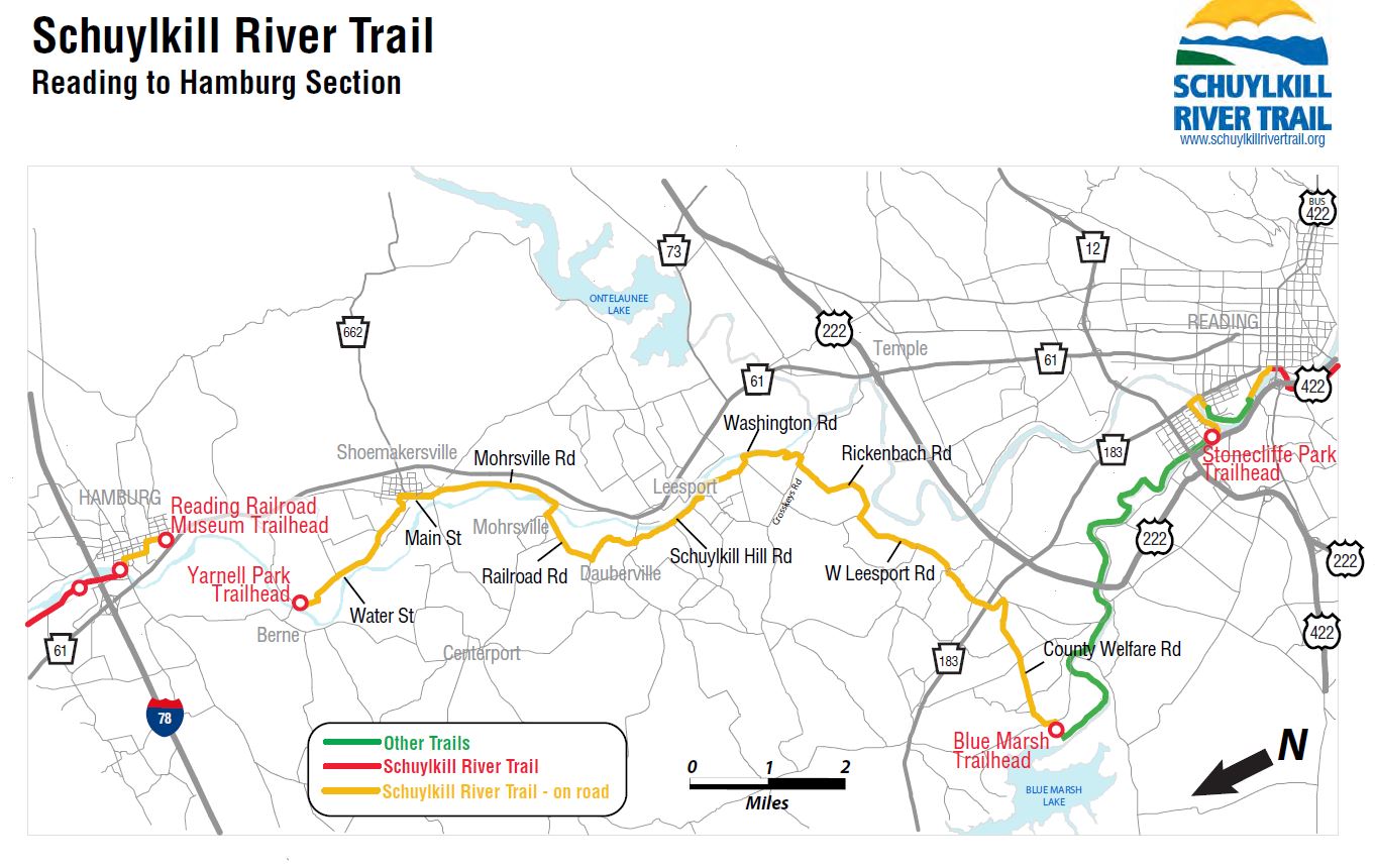
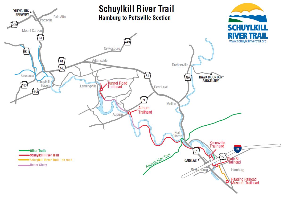
The Schuylkill River Trail between Reading and Hamburg is currently a 20-mile signed, on-road route that enables cyclists to make their way from Reading, where the trail currently breaks off, to Hamburg, where it can be accessed again from the State Street Trailhead. An off road trail will be constructed as property and funding become available.
Trailheads
Sites Along the Trail
(Click here for a larger view of the map)
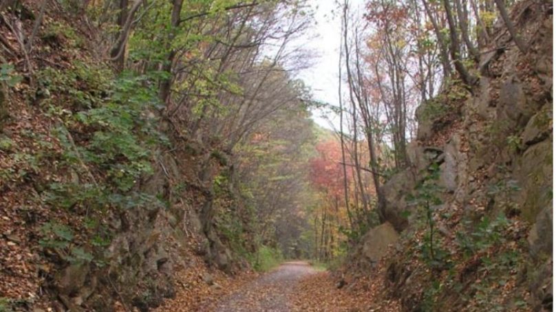
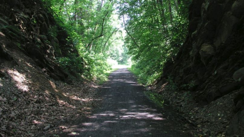
The Schuylkill River Trail between Hamburg and Frackville is partly completed. A 7-mile rural section between Hamburg and Auburn is open and runs along the side of Blue Mountain, above the Schuylkill River and a rail line. The Appalachian Trail, National Scenic Trail from Maine to Georgia, crosses the trail near Port Clinton. This is a very scenic section of the Schuylkill River Trail. It ends at an old railroad bridge which is currently closed off. The Auburn Gap Project will expand the trail beyond that point but at the present time trail users must turn around at the bridge.
The community of Hamburg retains its Pennsylvania Dutch heritage and small town lifestyle. Trail users are encouraged to visit Hamburg diners, hotels and shops. Find out more about theses attractions on the Hamburg, PA website.
Trail Project Status
A former Pennsylvania Railroad bridge in Auburn will be rehabilitated as part of the extension of the Schuylkill River Trail. The final design drawings are expected to be completed by fall 2019 with bids being accepted in spring 2020. The target date for the project completion is winter 2020. To learn more, CLICK HERE.
Trailheads
Site Along the Trail
Photo Gallery
Bartam Trail Section
Kernsville_Bartram Shadows
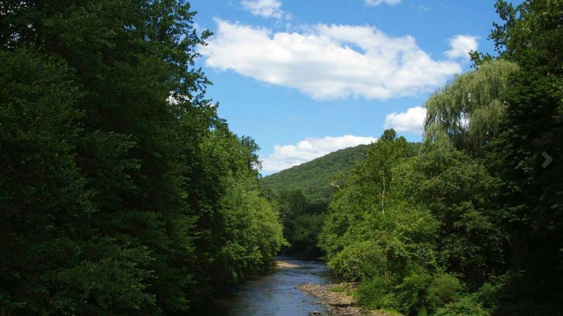
Schuylkill River at Port Clinton
Who Owns the Schuylkill River Trail?
The Schuylkill River Trail was built, and is managed, by different organizations and municipalities. These groups include: Schuylkill River Development Corp. (Schuylkill Banks), Philadelphia Parks & Recreation, East Falls Development Corp., Manayunk Development Corp., Montgomery County, Valley Forge National Historical Park, Borough of Pottstown, Chester County, Borough of Phoenixville, Berks County, Schuylkill River Greenways NHA, Borough of Hamburg, and Schuylkill County. For a list of contacts for each specific trail section, click the button below.
Trail Partners