Map Controls
- Reset the map
- View Trailheads
- View Trail Towns
- View Places to Visit
Map Legend
- Trailheads
- Trail Towns
- Places to Visit
- Schuylkill River Trail (SRT)
- On-Road SRT
- Proposed SRT
- Proposed On-Road SRT
Plan Your Trip
USING THE MAP
The Schuylkill River Greenways map is divided by Trailheads, Trail Towns and Places to Visit.
- Click on the category of your choice and a dropdown list of content will appear. Click any of the options within the dropdown menu and additional content will appear. Or, click on the “Places to Visit” category to see all available activities along the trail.
- Another way to navigate the map is to rollover the icons on the map. The preview will show you what kind of item it is. Click on it to reveal more information.
- Use the quick links at the top left to filter through Trailheads, Towns, and Places to Visit.
Trailheads/Parking
Trail Towns
Places to Visit
Kernsville Dam Recreation Area


PLEASE NOTE: The Kernsville Dam area is CLOSED and marked NO TRESPASSING. This includes the Peace Rock area and the Kernsville Dam itself. The first parking lot is still open to the public for parking so that visitors may legally use the Schuylkill River Trail Bartram Section. Boaters are allowed to use the river, aside from the area immediately before and after the dam.
The following statement was issued by the Pennsylvania Dept. of Environmental Protection in August 2016: “The Pennsylvania Department of Environmental Protection would like to remind Pennsylvania residents and visitors that the property along the Schuylkill River upstream of the Kernsville Dam to state Route 61 is not a public area and should not be used as such. Use of the property alongside and near the river, including Peace Rock, the dam, the beach area and all adjacent areas, is considered trespassing, except to provide portage around the Kernsville Dam. There are features on the properties at Kernsville Dam that present hazards to unauthorized persons. Boaters are allowed to use the river, aside from the area immediately before and after the dam, in accordance with PA Fish and Boat Commission rules and regulations.”
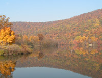
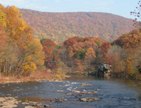
The Kernsville Dam and its attendant desilting basin was erected in 1949 to capture and remove coal silt from the river. The area has become an important wilderness area, boasting a variety of wildlife in the water, in the air and on the land.
The Appalachian Trail, running from Maine to Georgia, tracks through its upper reaches and the John B. Bartram Section of the Schuylkill River Trail has a trailhead across from the Desilting Monument.